NWS says funnel cloud formed in St. Joseph County Tuesday evening
Posted: Jun 25, 2019 10:47 PM EDT
Well, Mother Nature was at it again Tuesday evening. Unlike the June 23rd "freak" tornadoes, there was actually a decent chance of severe weather. So the severe thunderstorms didn't necessarily catch anyone off guard.
There was even a very low (2%) chance of tornadoes for areas north of U.S. 30 according to the Storm Prediction Center.
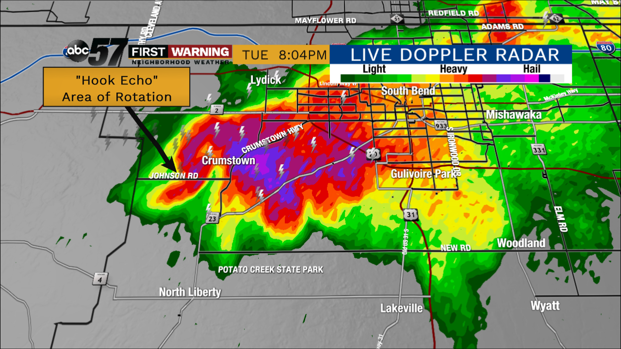 Supercell thunderstorm that had a tornado warning briefly Tuesday evening.
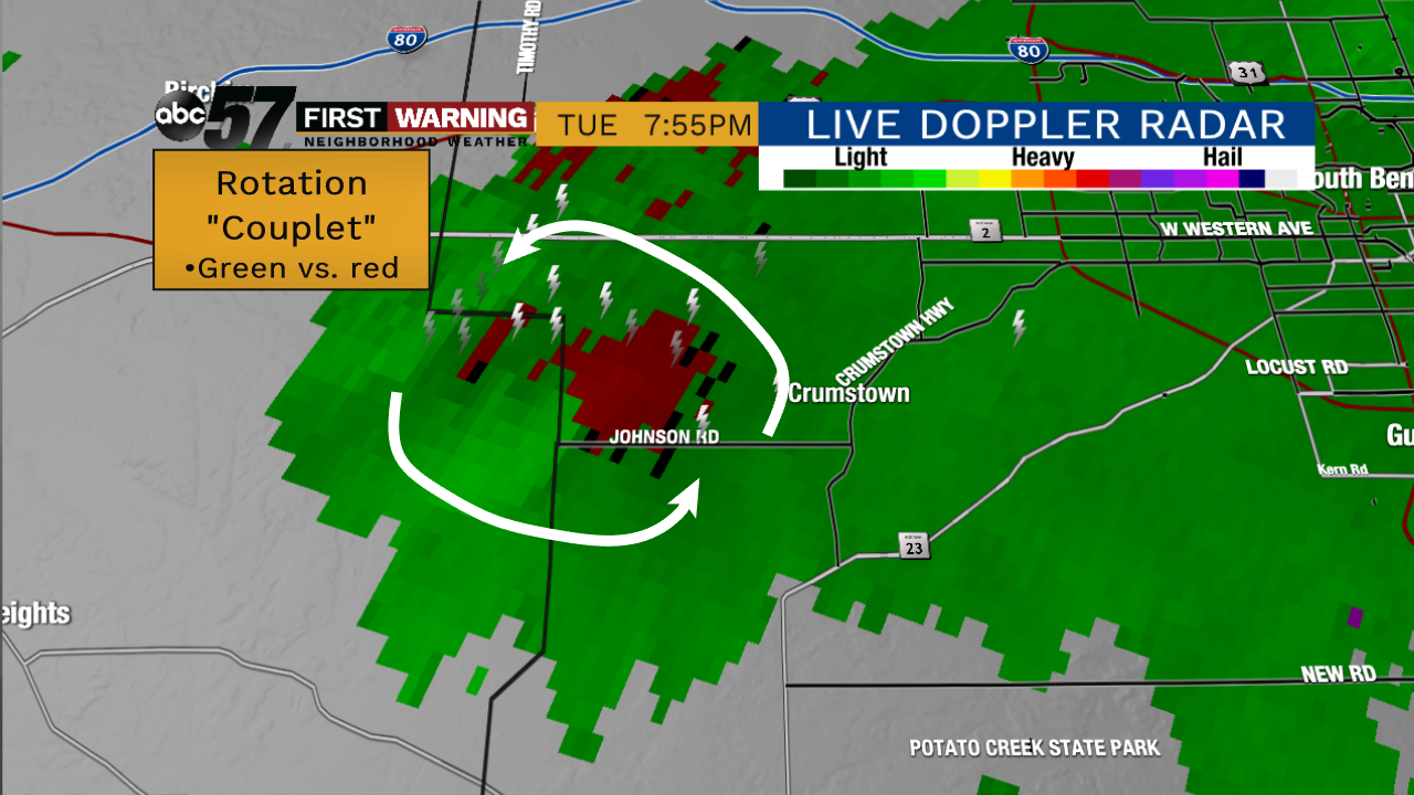 Velocity product shows a rotation couplet along the La Porte-St. Joseph County line (red vs. green).
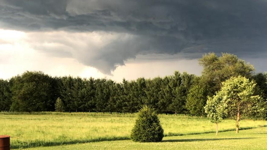
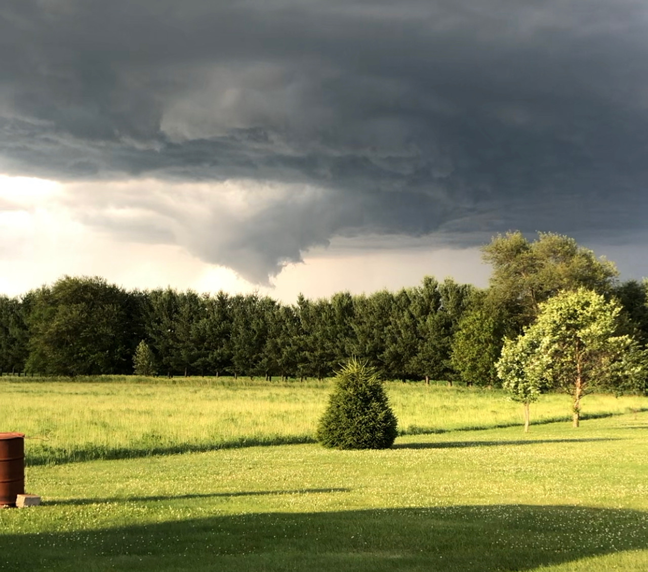 Possible wall cloud and funnel cloud seen looking north from North Liberty at 8 p.m. Tuesday evening.
Thanks for the picture Tyler! Looking north from North Liberty would make sense. Appears to be well developed wall cloud with a funnel cloud. Rotation from radar did not last long, but was impressive a short time.
— NWS Northern Indiana (@NWSIWX) June 26, 2019
While there are no reports of tornadoes, this funnel cloud and tornado warned-supercell continued a busy severe weather year for Michiana. If you have any photos or videos, send them on in to us!