
-
0:54

Goodwill ’Little Black Dress’ event raises funds for community...
-
1:45

Cheers Bar and Grill liquor license renewed following controversy
-
2:40

Kyle Rudolph weighs in on fellow Irish, Joe Alt, ahead of NFL...
-
0:58

Contractors prepare bids for multi-million-dollar Four Winds...
-
3:11

Caleb Williams and Marvin Harrison Jr. weigh in on upcoming draft
-
3:18

New settlement with Indiana allows Landmark to apply for recertification
-
2:32

NFL Analysts break down Joe Alt’s stock
-
1:21

Fair Thursday wet / windy weekend
-
2:52

Union Township sues UNAS over ambulance stripped for parts
-
1:32

Bridging the healthcare gap in Michiana
-
1:44

Drier but cooler weather returns for Wednesday
-
2:32

County Council asks questions on 900-acre Granger rezoning and...

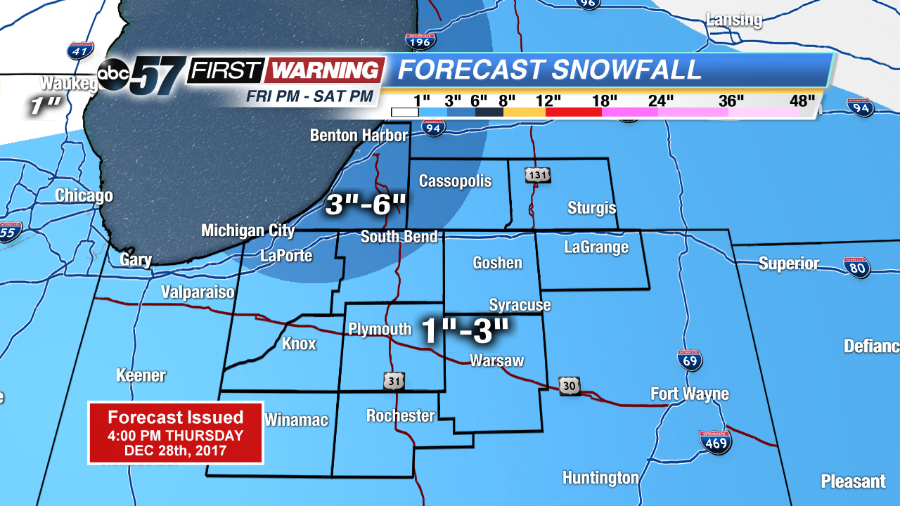
Not as cold tonight, temperatures will stay above zero but snow returns to the forecast. Light snow, less than an inch for most the area Thursday night into Friday morning.
The big question will be if we break 20 on Friday, it’s the only day that it could happen in the next week. The warm-up will precede a clipper system that will bring area-wide significant snowfall Friday night and Saturday. A widespread one to three inches is likely Friday night with lake effect adding at least another one to three Saturday, for some. Bitter cold returns for New Year’s with lows falling back below zero early next week.
Tonight: Light snow showers, low of 8.
Friday: Mostly cloudy, snow starting by the evening, high of 18.
Saturday: Lake effect snow, high of 14.
Sunday: Mostly cloudy, highs in the low teens.