More snow tonight, then sunshine returns
Posted: Mar 13, 2018 4:36 PM EDT

-
2:36

Aspiring chefs are cultivating their dreams at Ivy Tech
-
1:40

Rainy and breezy Tuesday
-
0:58

Hockey team hosts ’Rally for Rudy’ car wash
-
1:06

South Bend School Board of Trustees reviewing the code of conduct
-
2:33

Newly annexed land in Mishawaka could see a Gurley Leep auto...
-
3:48

Farmers react to recent trend of farmland sales in St. Joseph...
-
2:47

Reaction to potential TikTok ban
-
2:49

Michigan City Fire Department holds ’Firefighter for a Day’...
-
1:27

Ivy Tech program building future auto technicians
-
2:43

Elkhart elated about Big Balloon Build
-
1:34

Volunteers use Earth Day to spruce up Woodlawn Park Trail
-
3:50

Labor complaint filed over ’student-athlete’ classification

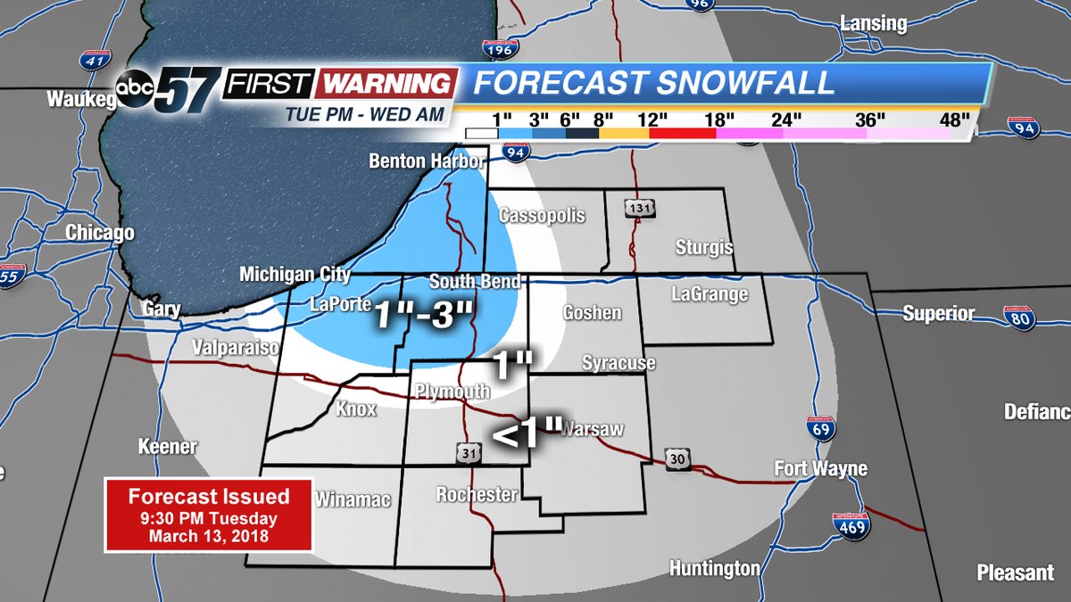
Snow squalls continue Tuesday night, ending by mid-morning Wednesday. A band of heavy lake effect snow cut across St. Joseph, Berrien and La Porte Counties, roads may be covered in the morning.
Snow ends Wednesday morning and skies clear for the afternoon. The pattern ahead has more sunshine but temperatures struggle to warm. Highs stay in the lower 40s to end the week, the weekend still looks fair, with highs in the mid to upper 40s. Next week high temperatures stay below normal.
Tonight: Lake effect snow showers, low of 22.
Wednesday: Morning snow showers, then clearing, highs near 40.
Thursday: Partly cloudy, high of 40.
Friday: Sunny, highs near 40.
Sign up for the ABC 57Newsletter