
-
3:01

New Buffalo Area Schools to build workforce housing
-
7:27

Center for the Homeless hosting Dancing With Our Stars
-
2:10

More wet weather arriving later tonight, but sunnier skies after
-
3:16

Public input on the proposal to restart the Palisades Nuclear...
-
1:35

Dari Fair opened Wednesday for 2024 season, temperatures cool...
-
1:22

Another round of rain, then a cool weekend
-
4:33

Should Indiana’s abortion records be public?
-
2:52

Trailblazing promotions at the South Bend Fire Department
-
1:30

Downtown South Bend and Notre Dame to see improved connectivity
-
1:44

Storm threat today holds relatively low severe risk
-
0:30

Officials share opioid settlement funding plan
-
1:04

Bonneyville Mill opens for the 2024 season

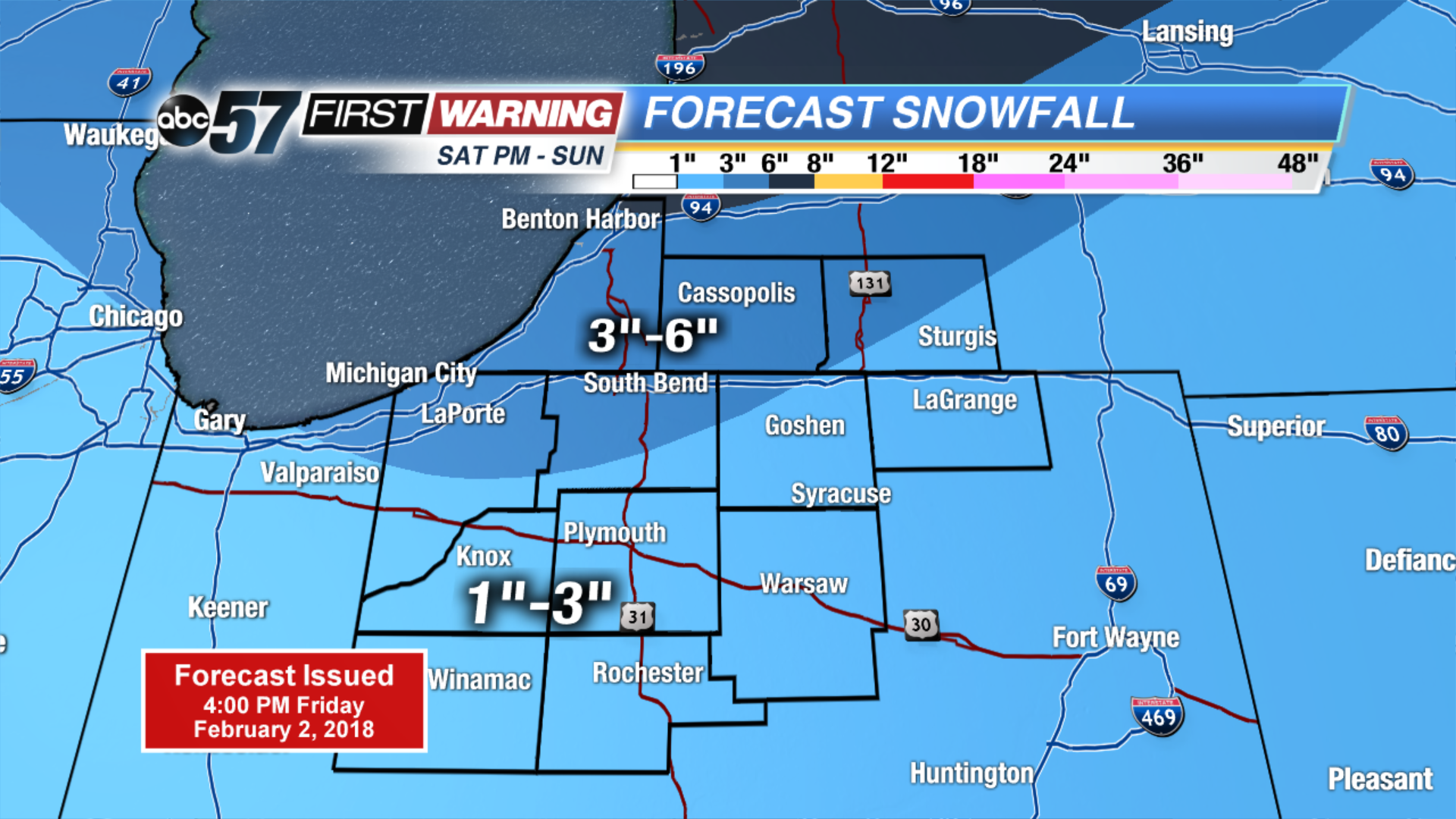
Temperatures warm through Saturday, highs may break the freezing mark ahead of our next round of snow. A storm system will bring a burst of snow Saturday night and light snow will continue through the first half of Sunday, with some lake enhanced snow showers. Many will see up to three inches of snow with amounts as high as six possible. Bitter cold continues next week, with more snow in forecast.
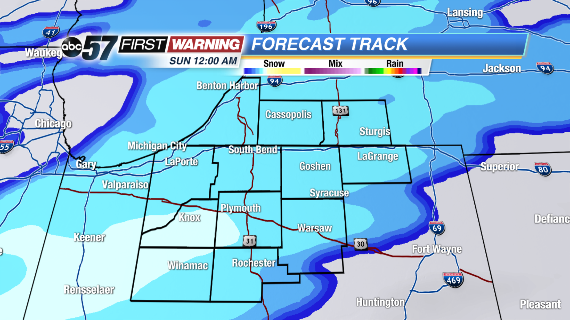
Tonight: Partly Cloudy, low of 14.
Saturday: Snow by the afternoon, high of 32.
Sunday: Snow showers through midday, temperatures fall from 30.
Monday: Mostly sunny, highs near 20.
Sign up for the ABC 57Newsletter