
-
1:52

While the rain is over, the cooling temperatures are not
-
2:28

Public forum hosted by John Glenn High School students
-
3:34

Kickoff preview with ABC57’s Allison Hayes
-
0:57

Completion of Martin Luther King Jr. Dream Center one step closer
-
0:36

Niles High School students network with local professionals
-
3:59

Political group asks Indiana Democrats to vote in Republican...
-
3:01

New Buffalo Area Schools to build workforce housing
-
2:37

City seeks feedback for final Potawatomi Park plan
-
7:27

Center for the Homeless hosting Dancing With Our Stars
-
2:10

More wet weather arriving later tonight, but sunnier skies after
-
3:16

Public input on the proposal to restart the Palisades Nuclear...
-
1:35

Dari Fair opened Wednesday for 2024 season, temperatures cool...

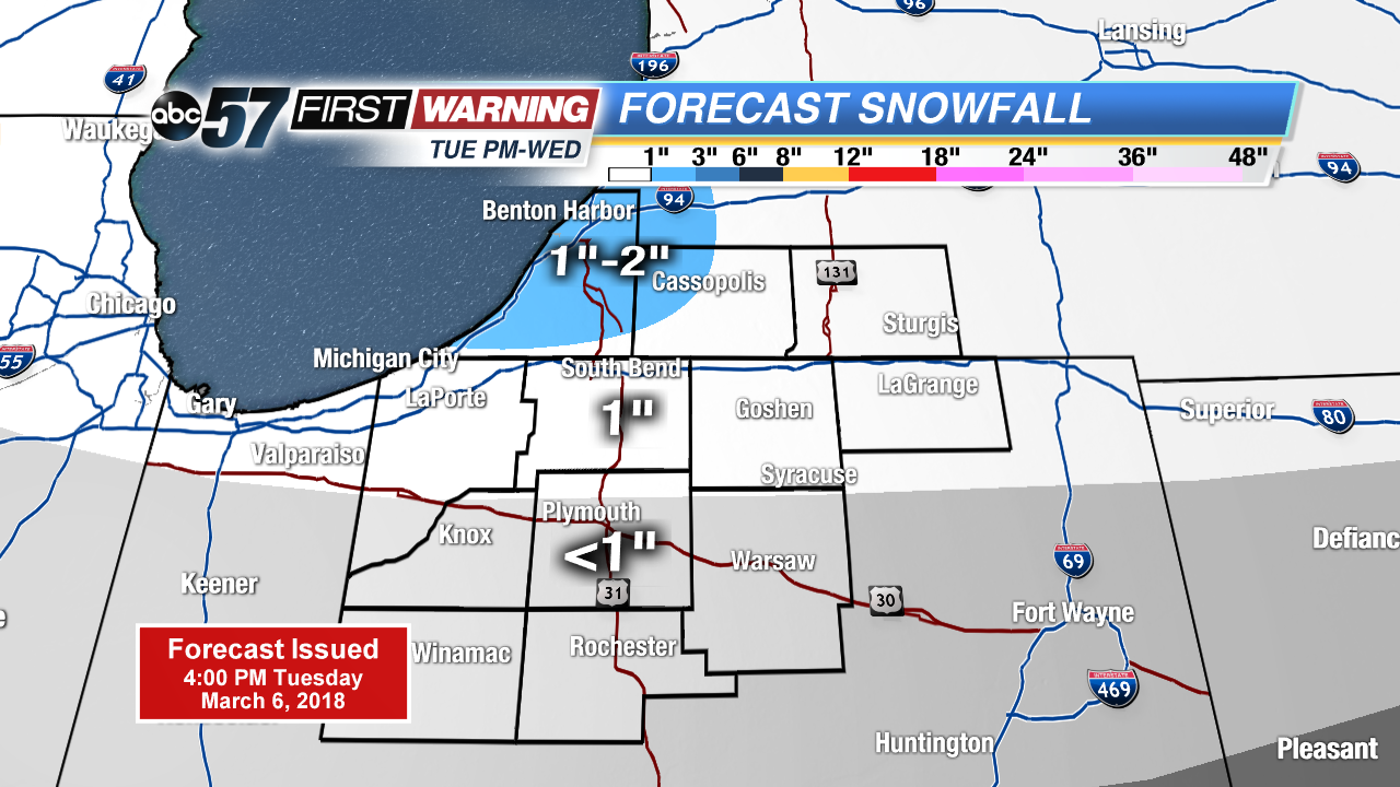
Another night of wintry mix changing to all snow. Accumulation of one to two inches is possible through Wednesday morning. Roads may have a few slick spots for the morning drive.
Snow showers continue Wednesday and cold weather prevails through midweek. As snow showers taper down Wednesday, there still could be some flakes into Thursday but it’s mostly flurries with little accumulation. Temperatures stay below normal through the weekend, before clouds break and temperatures rise gradually next week.
Tonight: Scattered snow showers, low of 28.
Wednesday: Mostly cloudy, light snow and breezy, high of 32.
Thursday: Mostly to partly cloudy, chance of snow, high of 30.
Friday: Mostly sunny, highs in the mid-30s.
Sign up for the ABC 57Newsletter