
-
0:54

Goodwill ’Little Black Dress’ event raises funds for community...
-
1:45

Cheers Bar and Grill liquor license renewed following controversy
-
2:40

Kyle Rudolph weighs in on fellow Irish, Joe Alt, ahead of NFL...
-
0:58

Contractors prepare bids for multi-million-dollar Four Winds...
-
3:11

Caleb Williams and Marvin Harrison Jr. weigh in on upcoming draft
-
3:18

New settlement with Indiana allows Landmark to apply for recertification
-
2:32

NFL Analysts break down Joe Alt’s stock
-
1:21

Fair Thursday wet / windy weekend
-
2:52

Union Township sues UNAS over ambulance stripped for parts
-
1:32

Bridging the healthcare gap in Michiana
-
1:44

Drier but cooler weather returns for Wednesday
-
2:32

County Council asks questions on 900-acre Granger rezoning and...

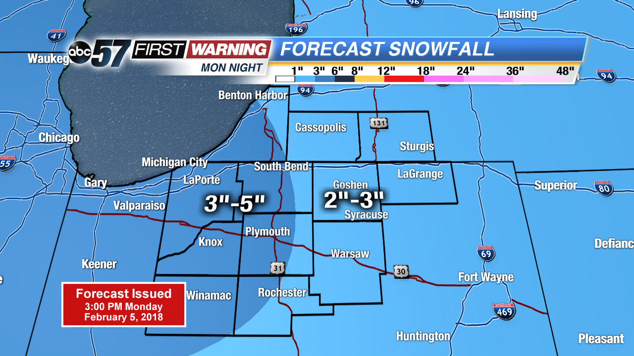
Another round of snow starts Monday evening and lasts through early Tuesday morning. A widespread three inches of snow is likely before the AM drive. A few flurries may last through the morning.
A brief lull in the snow Tuesday, highs will struggle to warm into the low 20s. The next round of snow in the active weather cycle swings through Wednesday morning, likely to bring another three inches to many. There’s another break Thursday before a similar system Thursday night and Friday.
Tonight: Snow showers, low of 12.
Tuesday: Mostly cloudy, high of 20.
Wednesday: Snow showers, high of 22.
Thursday: Partly cloudy, high near 20, chance of snow late.
Sign up for the ABC 57Newsletter