
-
1:52

While the rain is over, the cooling temperatures are not
-
2:28

Public forum hosted by John Glenn High School students
-
3:34

Kickoff preview with ABC57’s Allison Hayes
-
0:57

Completion of Martin Luther King Jr. Dream Center one step closer
-
0:36

Niles High School students network with local professionals
-
3:59

Political group asks Indiana Democrats to vote in Republican...
-
3:01

New Buffalo Area Schools to build workforce housing
-
2:37

City seeks feedback for final Potawatomi Park plan
-
7:27

Center for the Homeless hosting Dancing With Our Stars
-
2:10

More wet weather arriving later tonight, but sunnier skies after
-
3:16

Public input on the proposal to restart the Palisades Nuclear...
-
1:35

Dari Fair opened Wednesday for 2024 season, temperatures cool...

Bitter cold, light snow showers and flurries will continue not just Tuesday but the rest of the week. Highs will struggle to break into the double digits, with overnights lows in the single digits and at times nearing zero. The bitter cold will keep roads slick, sunshine and salt have a hard time being effective with frigid temperatures. We’ll watch the weekend for another round of significant snowfall.
Tonight: Mostly cloudy with light lake effect snow, low 6.
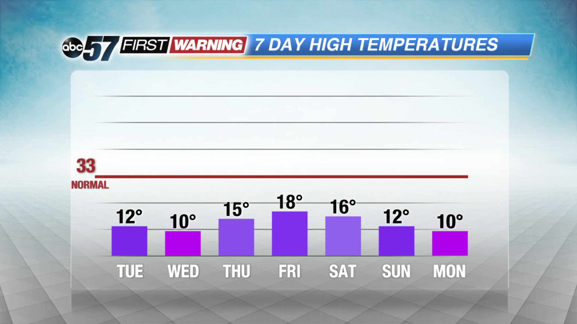
Tuesday: Mostly to partly cloudy and breezy with a chance of lake effect snow showers mainly in Michigan. High of 12.
Wednesday: Partly cloudy, slight chance of snow, high of 10.
Thursday: Partly cloudy, highs in the mid-teens.
Sign up for the ABC 57Newsletter