Local changes affecting Maria's path

-
2:13

Sunny today, but expect a wetter and warmer weekend
-
0:54

Goodwill ’Little Black Dress’ event raises funds for community...
-
1:45

Cheers Bar and Grill liquor license renewed following controversy
-
2:40

Kyle Rudolph weighs in on fellow Irish, Joe Alt, ahead of NFL...
-
0:58

Contractors prepare bids for multi-million-dollar Four Winds...
-
3:11

Caleb Williams and Marvin Harrison Jr. weigh in on upcoming draft
-
3:18

New settlement with Indiana allows Landmark to apply for recertification
-
2:32

NFL Analysts break down Joe Alt’s stock
-
1:21

Fair Thursday wet / windy weekend
-
2:52

Union Township sues UNAS over ambulance stripped for parts
-
1:32

Bridging the healthcare gap in Michiana
-
1:44

Drier but cooler weather returns for Wednesday

Summer temperatures won't be around Michiana for long! A cold front will push through the area on Wednesday, allowing our highs to fall dramatically into the low to mid 70s and into the upper 60s by the end of the week. But, this front that will move through will also have other impacts on the East Coast.
Hurricane Maria continues to spin off the East Coast as a weak Category 1 hurricane. It will continue to push to the north over the next few days, edging ever closer to the Outer Banks of North Carolina by the middle of the week. By then, the front that'll bring fall into Michiana will be over the eastern portions of the United States, just making it in time to help push Maria farther out into the Atlantic as the front continues to slide to the east.
However, the East Coast won't be completely spared from Maria. Tropical Storm Warnings are now up for the Outer Banks of North Carolina, as gusty winds as high as 55 mph are expected in the area from Tuesday to Thursday.
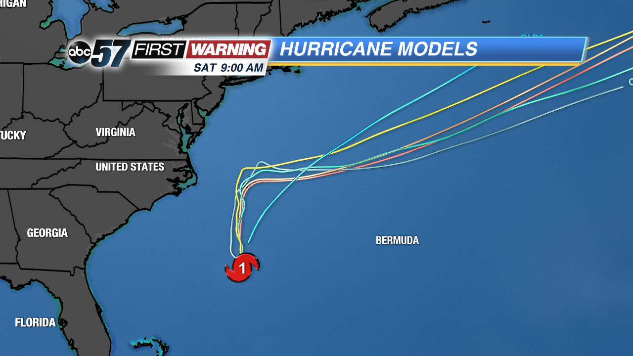 Models showing a northerly track of Maria until the cold front arrives to push the storm farther out into the Atlantic.