Lake effect snow and a cold Friday

-
2:10

More wet weather arriving later tonight, but sunnier skies after
-
3:16

Public input on the proposal to restart the Palisades Nuclear...
-
1:35

Dari Fair opened Wednesday for 2024 season, temperatures cool...
-
1:22

Another round of rain, then a cool weekend
-
4:33

Should Indiana’s abortion records be public?
-
2:52

Trailblazing promotions at the South Bend Fire Department
-
1:30

Downtown South Bend and Notre Dame to see improved connectivity
-
1:44

Storm threat today holds relatively low severe risk
-
0:30

Officials share opioid settlement funding plan
-
1:04

Bonneyville Mill opens for the 2024 season
-
0:32

Increase in federal funding coming to improve local hiking and...
-
3:07

Gun violence on the decline in South Bend

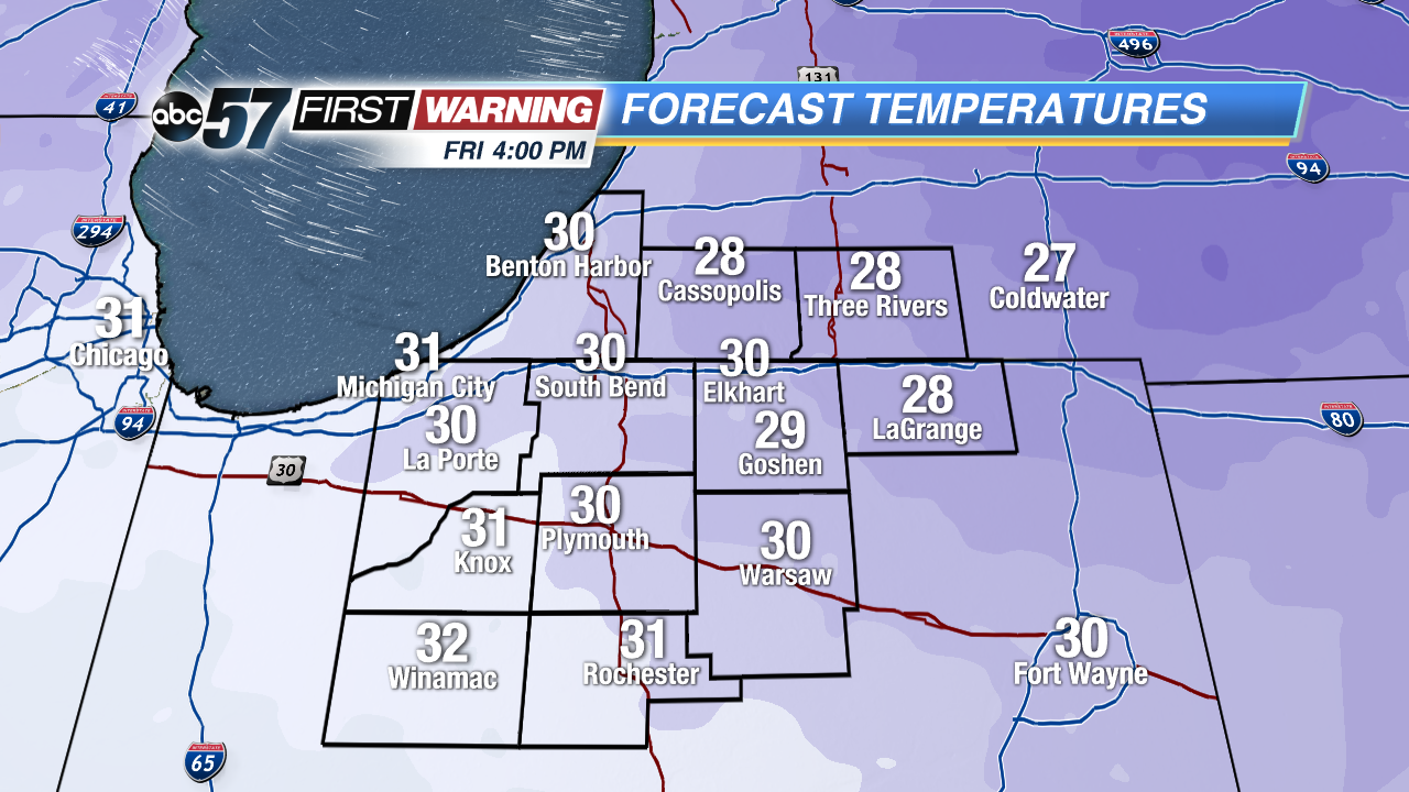 Highs may not break the freezing mark Friday afternoon
Temperatures plummet this evening into the 20s, lake effect snow will ramp-up overnight but will not last long. A dusting is possible with areas closer to the lake of an inch or more.
Friday will be the coldest day so far this season, temperatures will struggle to break the freezing mark. Temps warm slowly through the weekend. Saturday night into Sunday another storm system will bring a mix of rain and snow, changing to all rain and temps rise, Sunday morning. Next week will be milder with highs in the low 50s.
Tonight: Cold and breezy with lake effect snow showers, low 20. 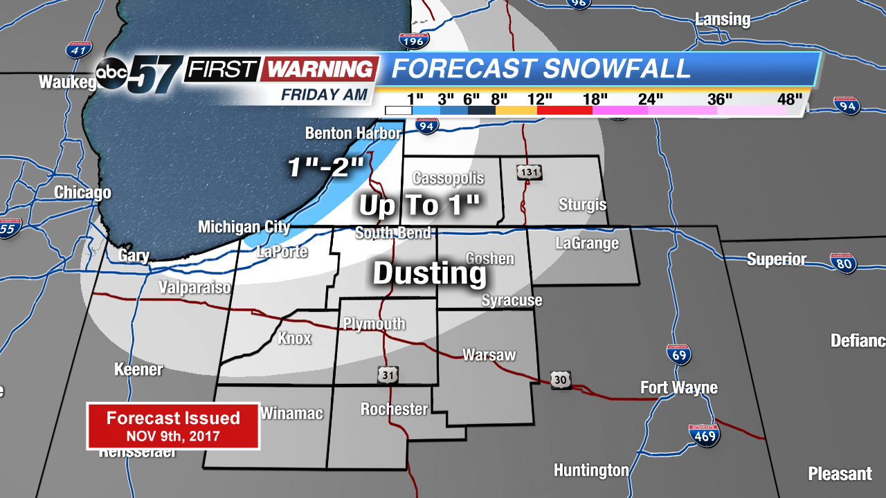 Lake Effect Snow forecast through Friday morning
Friday: Morning flurries, becoming mostly sunny, high of 32.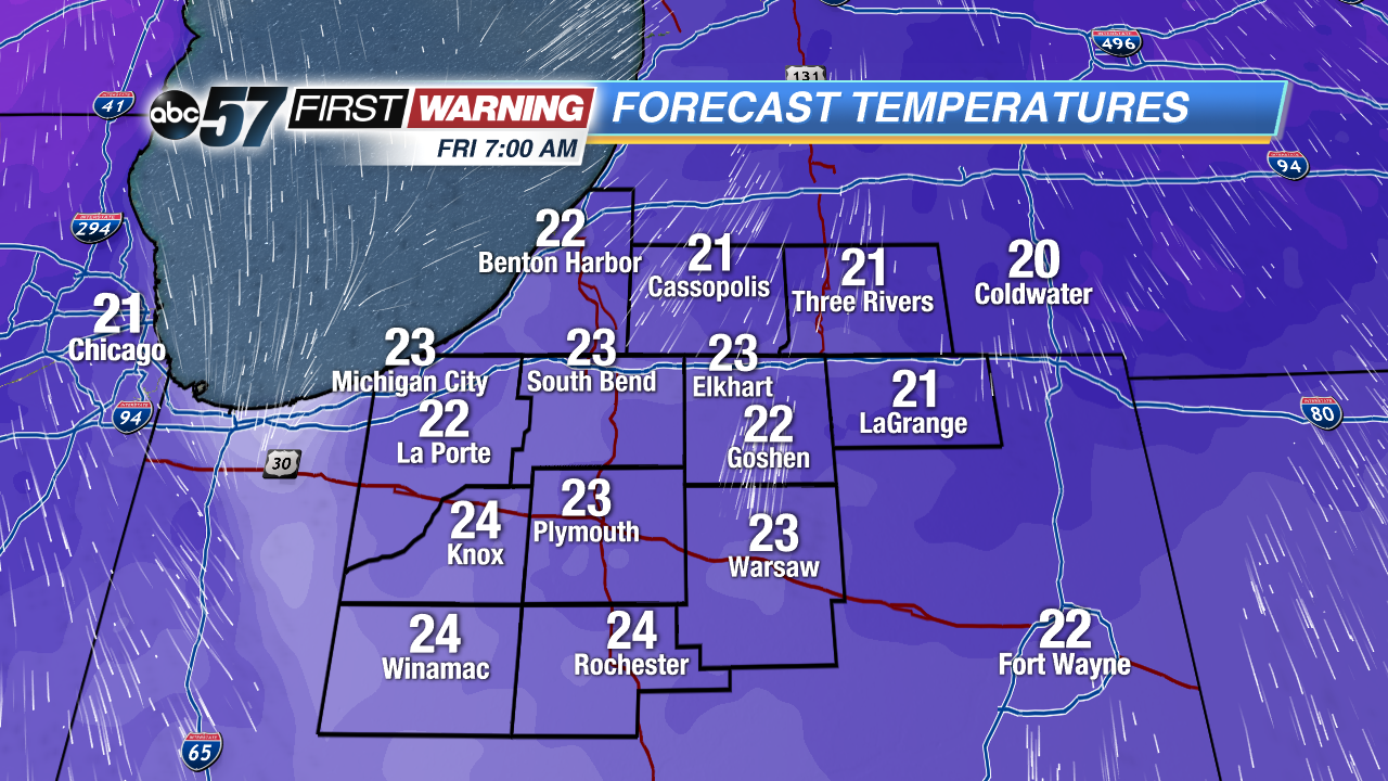 Lows Friday morning will be in the lower 20s
Saturday: Partly cloudy, high 40.
Sunday: Rain/snow mix changing to rain, highs in the low 40s.