High impact, multi-day lake effect snow event

-
2:13

Sunny today, but expect a wetter and warmer weekend
-
0:54

Goodwill ’Little Black Dress’ event raises funds for community...
-
1:45

Cheers Bar and Grill liquor license renewed following controversy
-
2:40

Kyle Rudolph weighs in on fellow Irish, Joe Alt, ahead of NFL...
-
0:58

Contractors prepare bids for multi-million-dollar Four Winds...
-
3:11

Caleb Williams and Marvin Harrison Jr. weigh in on upcoming draft
-
3:18

New settlement with Indiana allows Landmark to apply for recertification
-
2:32

NFL Analysts break down Joe Alt’s stock
-
1:21

Fair Thursday wet / windy weekend
-
2:52

Union Township sues UNAS over ambulance stripped for parts
-
1:32

Bridging the healthcare gap in Michiana
-
1:44

Drier but cooler weather returns for Wednesday

Now through Friday evening will be a high impact lake effect snow event. Persistent snowfall will bring at least three to six inches per day in the lake effect zones, including South Bend and Elkhart. Higher amounts of 12 to 18 inches in southwest Michigan. Whiteout conditions are possible when crossing intense squalls. Use extreme caution when traveling the next two days.
There is a break from the snow Saturday, before a system warms the area into the 30s but brings additional snowfall Sunday and Monday.
Tonight: Lake effect snow showers, low of 8. 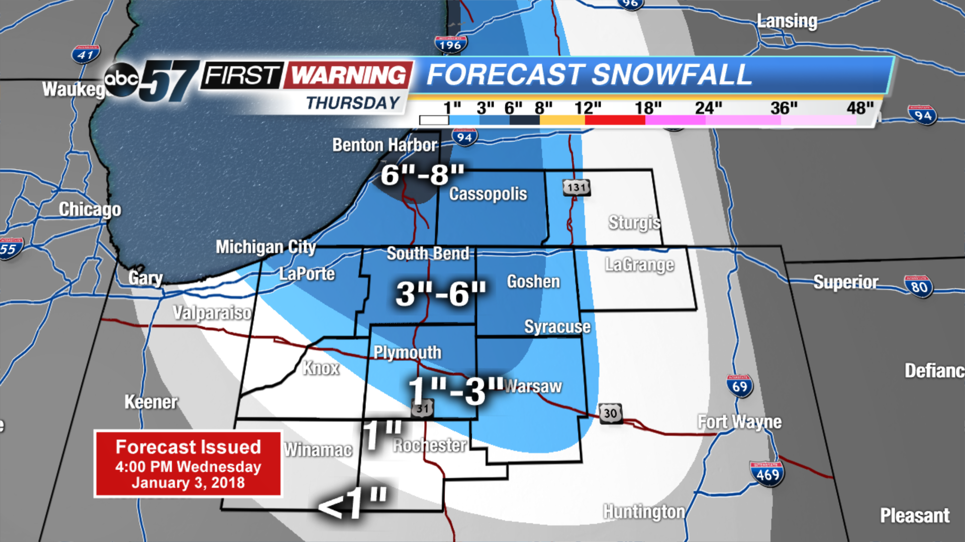 Thursday ONLY snowfall
Thursday: Lake effect snow showers, high of 12.b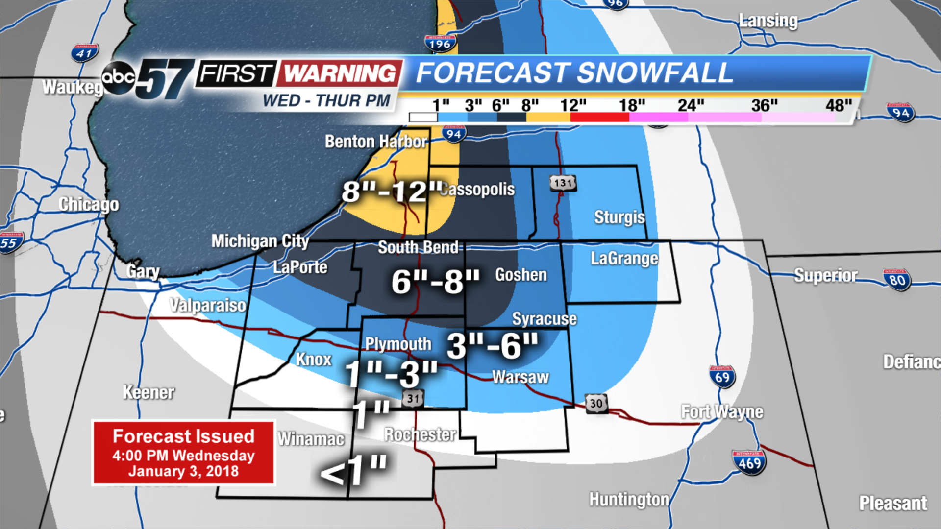 Estimated two day totals
Friday: Lake effect snow showers, high of 10.
Saturday: Partly cloudy, high of 15. ![]() High impact lake effect snow event.
High impact lake effect snow event.
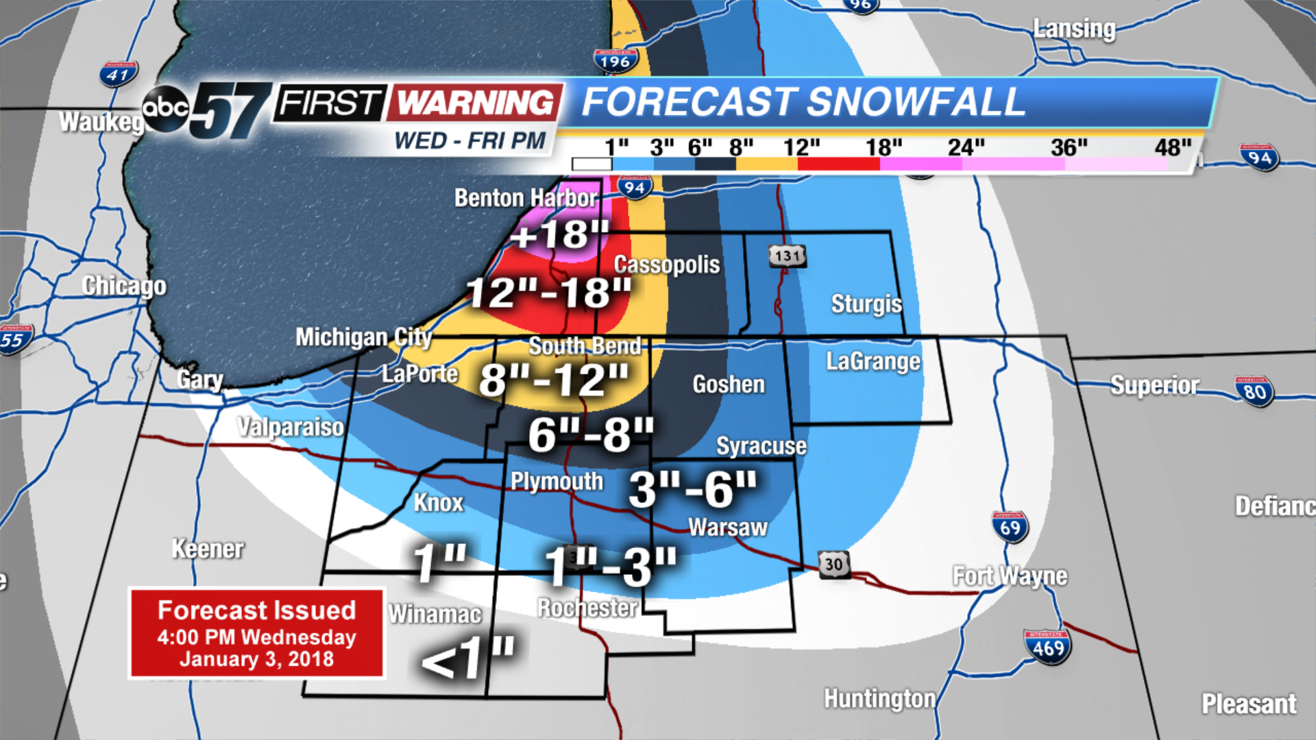 Estimated three day totals