Heavy rain and hail threat on Saturday


The weather for Saturday is not looking good! Since a stationary front will be right over Michiana, rain showers will repeatedly soak the area throughout the day.
From Friday overnight through Saturday afternoon, showers and some thunderstorms will move through, but less than an inch of rainfall will accumulate. However, more rain and strong to severe storms will move through Saturday evening and overnight, really adding up those numbers.
 GFS rainfall accumulation Friday through Sunday morning.
Because of the heavy amount of rain that will fall in a short period of time, the Weather Prediction Center has issued a slight risk of flash flooding for small streams. You can see where the highest threat, which is 10-20% in the orange.
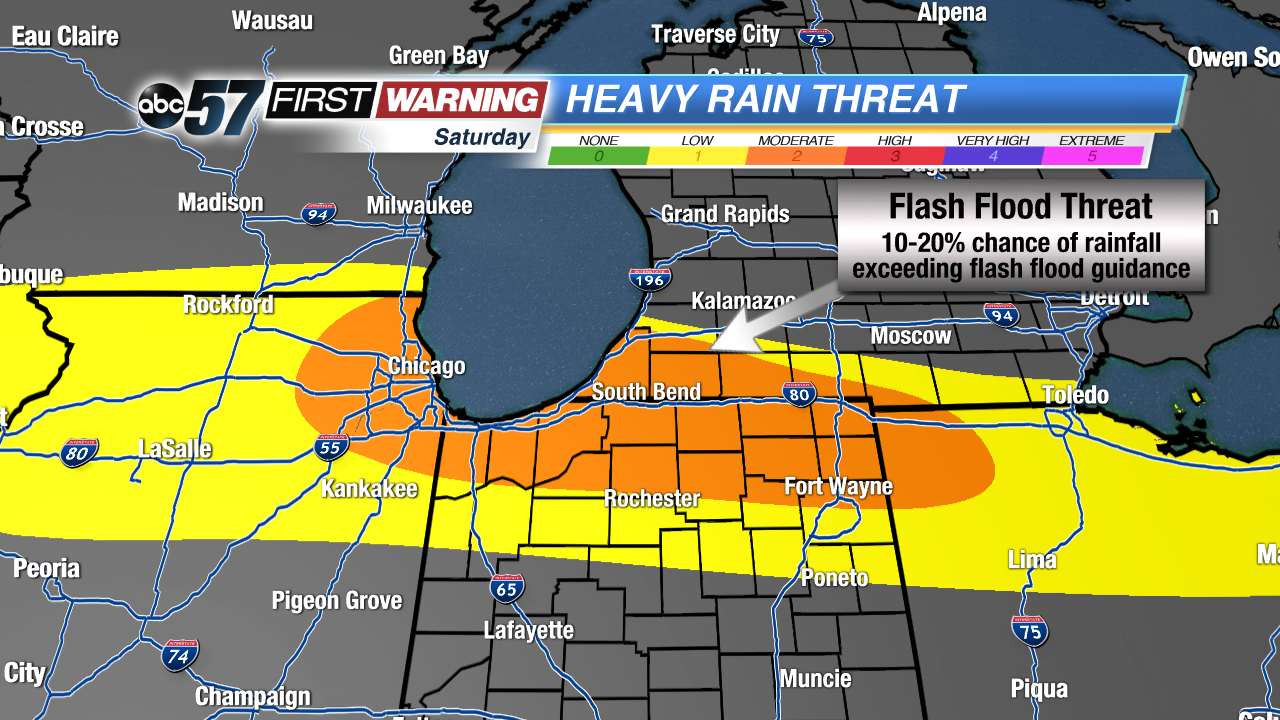
This is a reminder to never drive or walk through flood waters, because only 6" of water can sweep a person off of their feet.
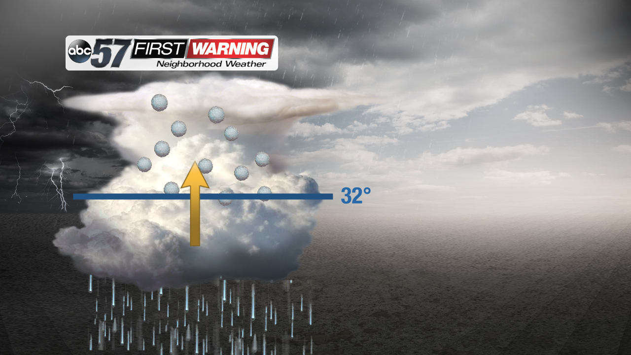
On top of heavy rain, we will also be tracking hail.
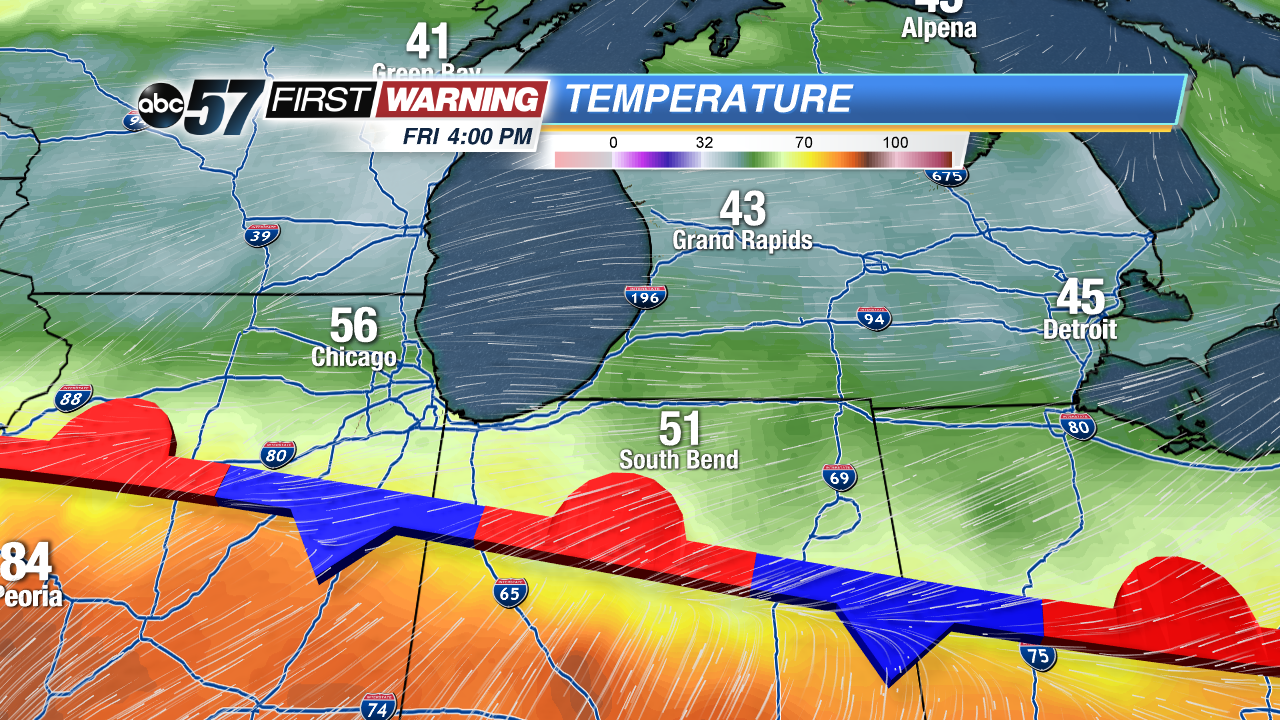
The stationary front will be right over Michiana, with cool air to the north and very warm air to the south. This boundary with cause the warm air to rise over the cold air. In tomorrow's particular situation, the storms will be able to grow very tall, and because of that, hail will be one of the primary threats.
Hail forms when rain drops are brought high into the cloud by a strong updraft. The taller a cloud is, the colder it is at the top, so once rain drops make it to the top part of the cloud, they will turn to ice and grow in size until the updraft cannot support their weight.
Be sure to tune into ABC57, and stay updated by alerts on the ABC57 First Warning Neighborhood Weather App, which is free in Apple and Android app stores.