Dense fog and drizzle accompanies midweek warm-up

-
1:52

While the rain is over, the cooling temperatures are not
-
2:28

Public forum hosted by John Glenn High School students
-
3:34

Kickoff preview with ABC57’s Allison Hayes
-
0:57

Completion of Martin Luther King Jr. Dream Center one step closer
-
0:36

Niles High School students network with local professionals
-
3:59

Political group asks Indiana Democrats to vote in Republican...
-
3:01

New Buffalo Area Schools to build workforce housing
-
2:37

City seeks feedback for final Potawatomi Park plan
-
7:27

Center for the Homeless hosting Dancing With Our Stars
-
2:10

More wet weather arriving later tonight, but sunnier skies after
-
3:16

Public input on the proposal to restart the Palisades Nuclear...
-
1:35

Dari Fair opened Wednesday for 2024 season, temperatures cool...

The thaw and fog cycle continues. Temperatures will be rising above freezing Wednesday morning, as light rain and drizzle move into the area. The combination of melting snow and falling rain will lead to a super-saturated lower atmosphere, the conditions for thick fog. Areas with the most snowpack will have the densest fog and coolest temperatures. There’s more rain and fog in the forecast for Thursday.
There is still much doubt in a potential ‘ major ‘ winter storm Friday and Saturday. That doesn’t mean we won’t see snow but a significant snowfall may not impact Michiana. There is still the potential significant snowfall and winter weather in the Midwest this weekend.
Tonight: Dense fog and drizzle developing overnight, low 30. 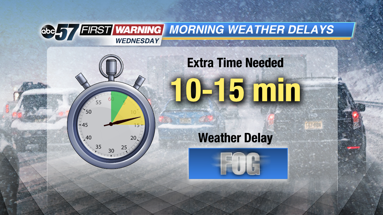
Wednesday: Fog and drizzle, high of 46.
Thursday: Rain and fog, highs near 50.
Friday: Snow showers, high of 30.