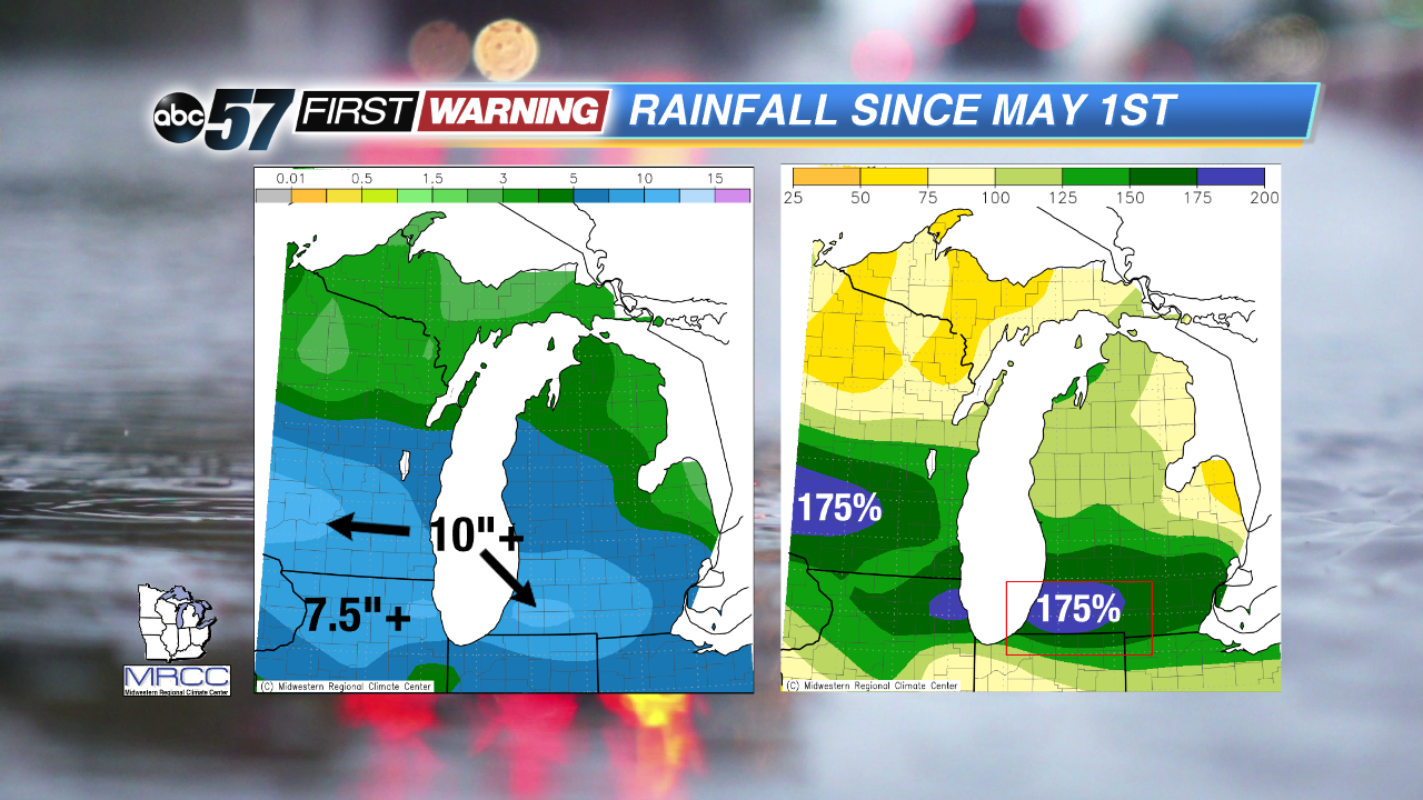
After breaking the monthly rainfall record for May, South Bend has continued to see its fair share of rainfall in June. Some parts of Michiana have seen several inches of rain already in June, leading to instances of flooding. Dating back to May 1st, a "bullseye" of total rainfall sits over northern and eastern Iowa, southern Wisconsin, northern Illinois, far northern Indiana, and southern Lower Michigan. Totals of at least 7.5" have been seen in all of those areas since May 1st. There are isolated locations within that geographical area that have seen well over 10" of rain! Parts of southwest Michigan, the Chicago metro area and southeast Wisconsin have seen roughly two times as much rain since May 1st as normal.
While the sheer totals are impressive and record-breaking in some instances, what has happened across east-central Indiana is even more remarkable. From May 1st to June 8th, most of central Indiana and Illinois saw 3-4" of total rain. Those amounts are by no means earth-shattering, but it put parts of those states in the "Abnormally Dry" category on the Drought Monitor. Fast-forward to the last three days, and cities like Indianapolis, Terre Haute, Lafayette, Effingham, and Decatur have seen nearly as much rain in 72 hours as they received during the May 1st to June 8th period. In other words, parts of both central Illinois and Indiana recorded nearly as much rain in less than three days as they did in 39 days!
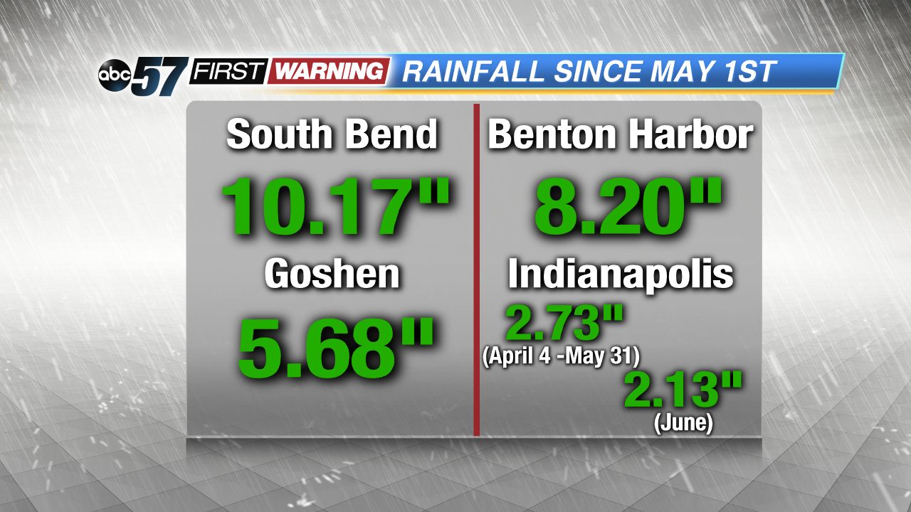
For Indianapolis, 2.73" of rain fell between April 4th and May 31st. Since June 1st, 2.13" of rain has fallen. The city has put a dent in the rainfall deficit that developed during the second half of April and much of May as a result of the wet beginning to June. And, that is something that will likely continue to happen as we move forward. Cities will have opportunities to see extremely dry and extremely wet conditions establish themselves quicker due to the effects of climate change and the warming atmosphere. Heavy rain events will continue to be more prominent. Thus, squashing droughts and unusually dry conditions will continue to be possible in as little as a couple of days due to the higher probability of heavy rainfall set-ups. It only takes one storm system to tap into the moisture in the Gulf of Mexico and drop a couple inches of rain in a day or two!