
-
0:25

Humane Society of St. Joseph County holds microchip clinic
-
2:58

Pulaski County Community Foundation provides support for childcare...
-
3:14

Green wave of economic growth in Michigan from marijuana dispensaries
-
1:28

Brisk, breezy but beautiful weekend
-
1:52

While the rain is over, the cooling temperatures are not
-
2:28

Public forum hosted by John Glenn High School students
-
3:34

Kickoff preview with ABC57’s Allison Hayes
-
0:57

Completion of Martin Luther King Jr. Dream Center one step closer
-
0:36

Niles High School students network with local professionals
-
3:59

Political group asks Indiana Democrats to vote in Republican...
-
3:01

New Buffalo Area Schools to build workforce housing
-
2:37

City seeks feedback for final Potawatomi Park plan

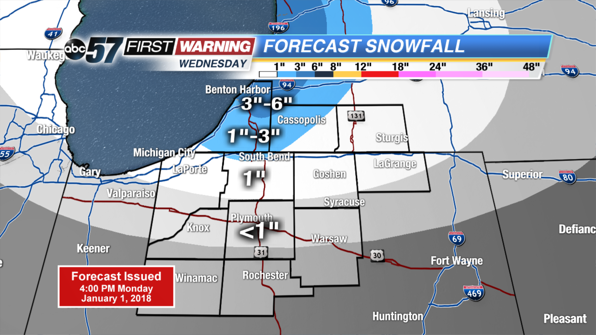
Tuesday may be the coldest day so far in the Frigid holiday season, temps start well below zero and highs will not break into the double digits. The wind chill will also be a factor staying mostly subzero. There is a short break from snow with mostly sunny skies. The next round of snow will be Wednesday – Thursday with another clipper, plus lake effect. Amounts will not be extreme but some areas could see another three to six by Friday morning.
Tonight: Partly to mostly clear, low of -8.
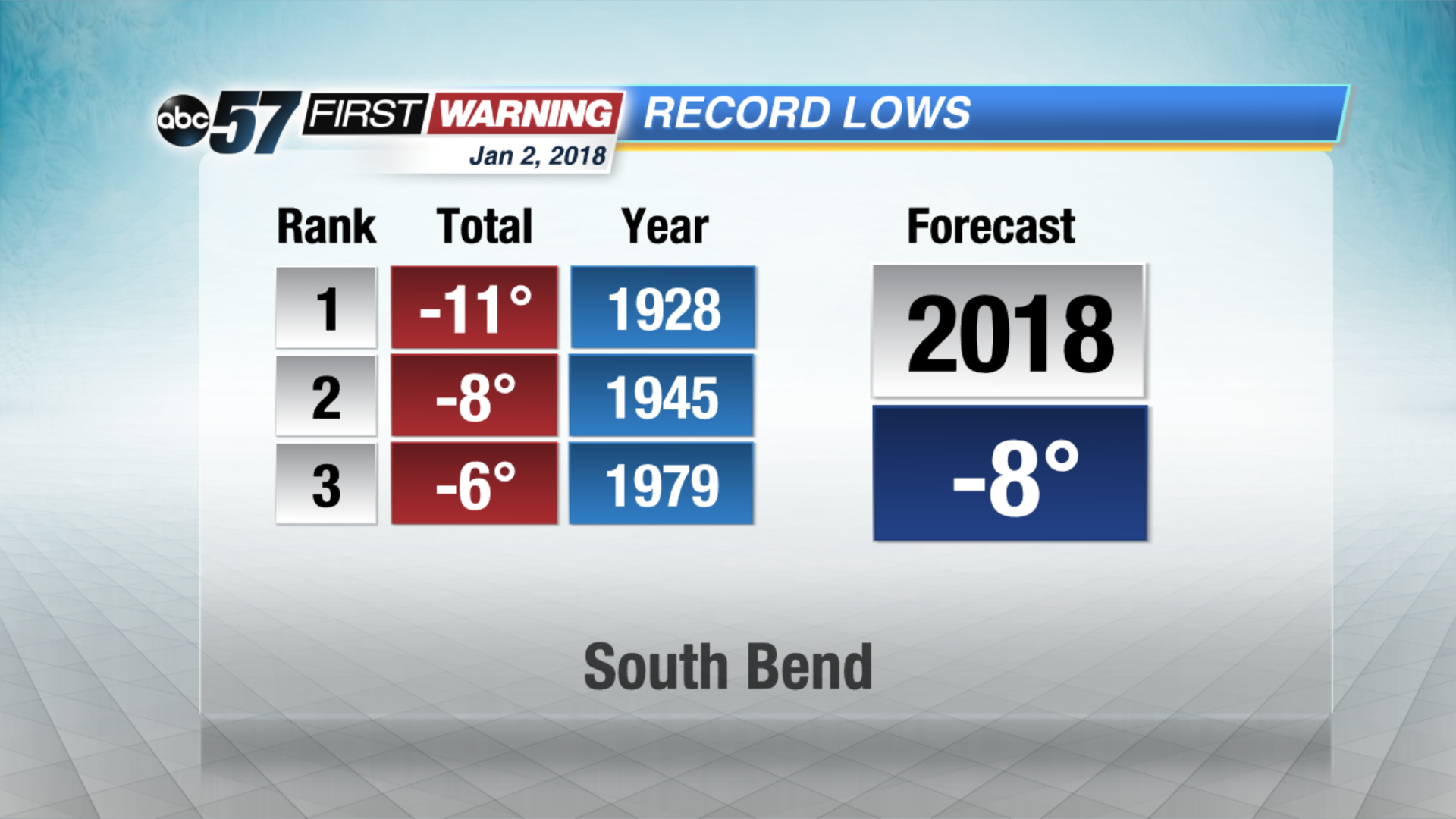 Forecast nearing record lows Tuesday morning
Tuesday: Mostly sunny. Highs near 6.
Wednesday: Mostly cloudy, afternoon and evening snow showers, high of 14.
Thursday: Lake effect snow showers, highs in the lower teens.
Sign up for the ABC 57Newsletter