Cold and active start to February
Posted: Jan 31, 2018 4:18 PM EDT

-
0:54

Goodwill ’Little Black Dress’ event raises funds for community...
-
1:45

Cheers Bar and Grill liquor license renewed following controversy
-
2:40

Kyle Rudolph weighs in on fellow Irish, Joe Alt, ahead of NFL...
-
0:58

Contractors prepare bids for multi-million-dollar Four Winds...
-
3:11

Caleb Williams and Marvin Harrison Jr. weigh in on upcoming draft
-
3:18

New settlement with Indiana allows Landmark to apply for recertification
-
2:32

NFL Analysts break down Joe Alt’s stock
-
1:21

Fair Thursday wet / windy weekend
-
2:52

Union Township sues UNAS over ambulance stripped for parts
-
1:32

Bridging the healthcare gap in Michiana
-
1:44

Drier but cooler weather returns for Wednesday
-
2:32

County Council asks questions on 900-acre Granger rezoning and...

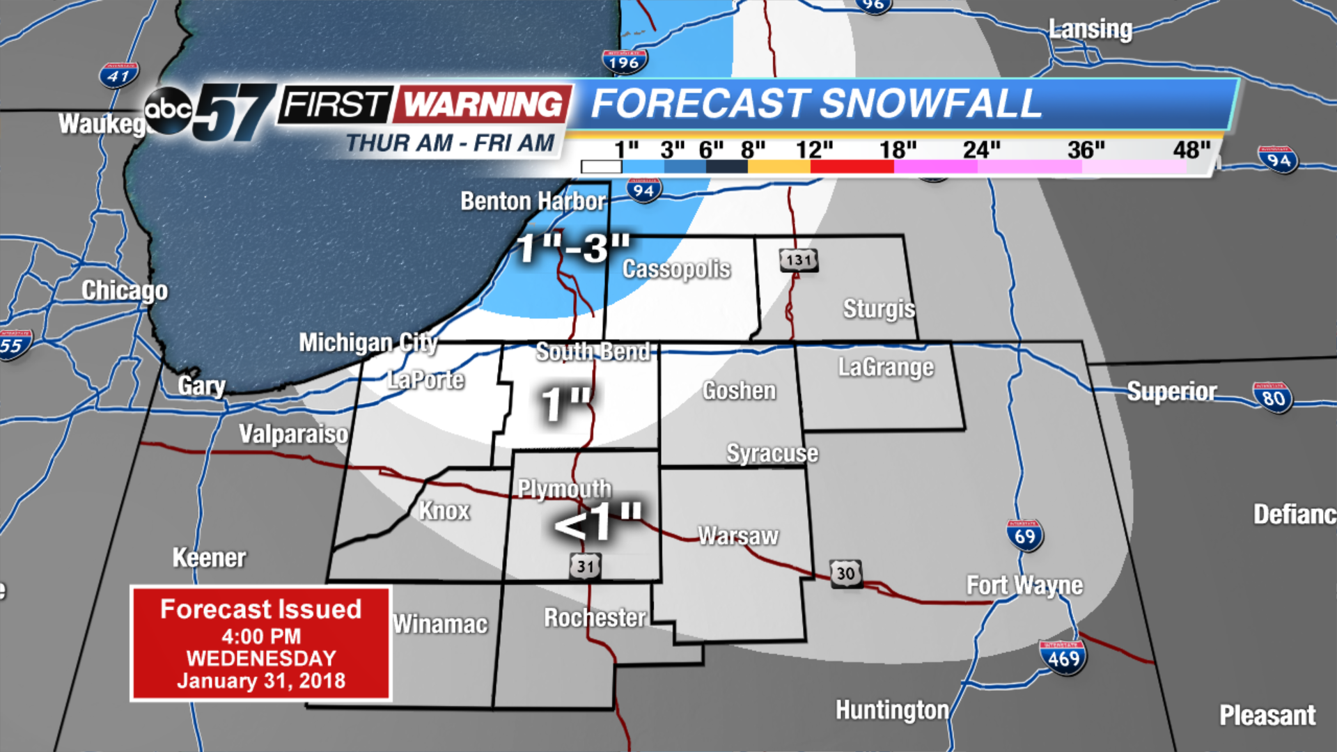
Temperatures fall through Friday, as bitter cold returns to start February. Highs are unlikely to break the freezing mark for at least the next week. An active pattern will bring a chance of snow about every other day. The quick moving systems may not bring a lot of snow individually but will add to the snowfall as a whole. The best chance for widespread accumulation is Friday.
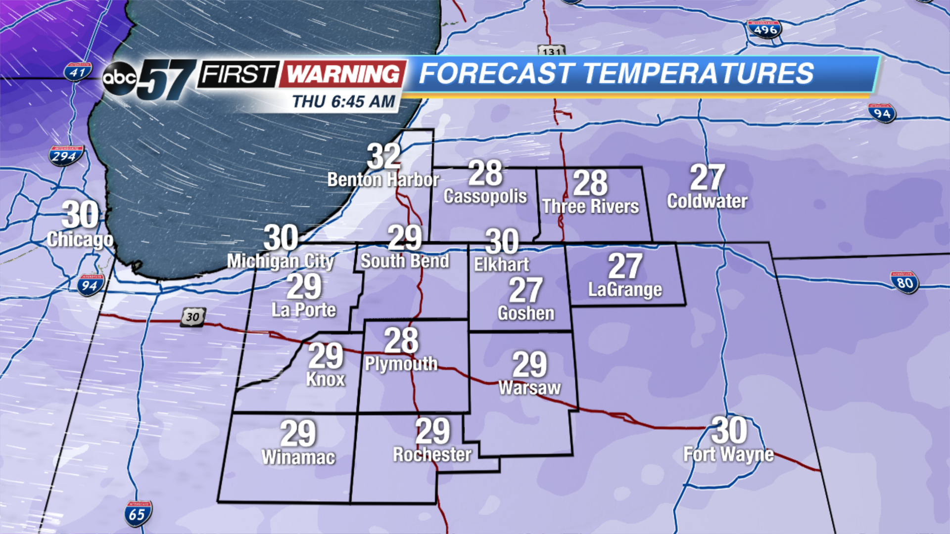 Temperatures Thursday Morning
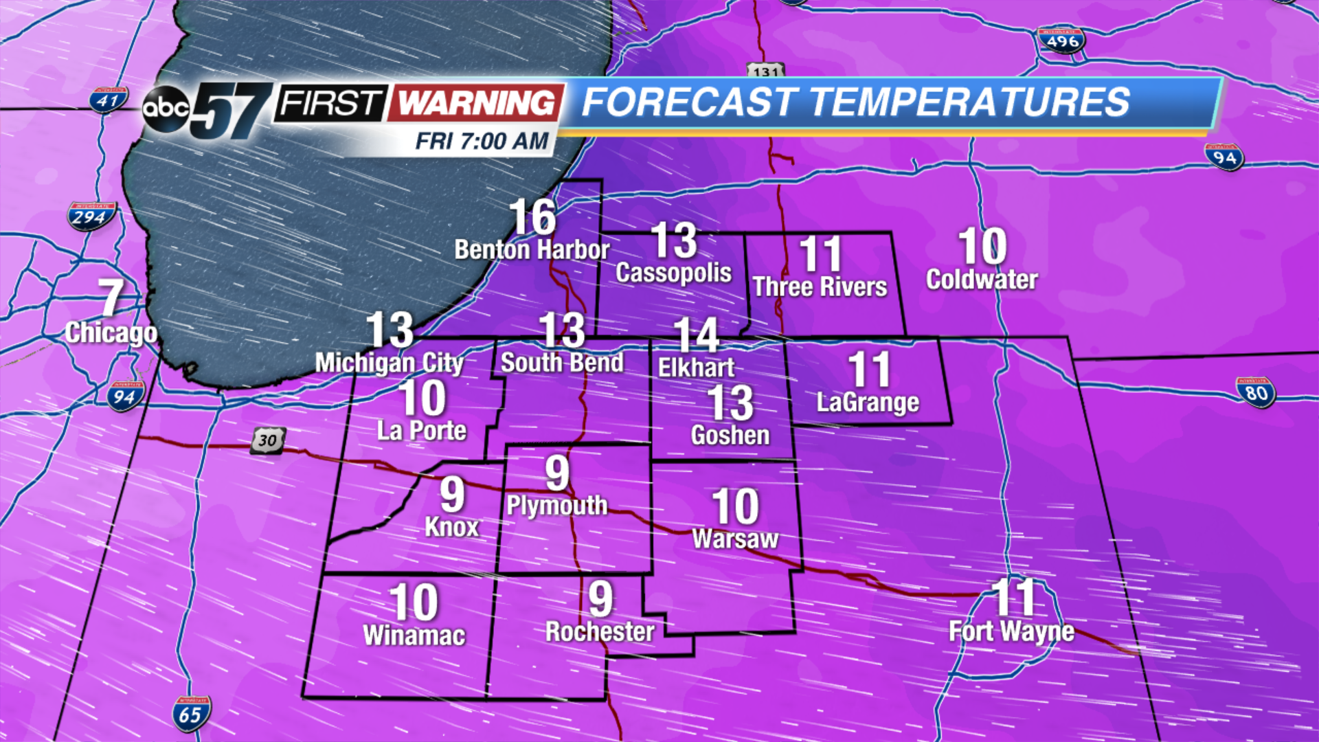 Temperatures Friday Morning
Tonight: Mostly cloudy, low of 30.
Thursday: Mostly cloudy with lake effect snow developing, temperatures fall from 32.
Friday: Partly cloudy, chance of snow early, highs in the teens.
Saturday: Snow by the afternoon, highs near 30.
Sign up for the ABC 57Newsletter