
-
1:32

Bridging the healthcare gap in Michiana
-
1:44

Drier but cooler weather returns for Wednesday
-
2:32

County Council asks questions on 900-acre Granger rezoning and...
-
0:56

Notre Dame women’s basketball team holds end-of-season awards...
-
0:45

Idea Week kicks off with networking at launch party
-
2:59

SBPD officer takes in six puppies while SBARC remains on Parvo...
-
1:45

How rain is hampering planting progress
-
2:43

From classrooms to rental units in Chikaming Township
-
1:47

Cooler and drier midweek, milder and wetter weekend
-
2:36

Aspiring chefs are cultivating their dreams at Ivy Tech
-
1:40

Rainy and breezy Tuesday
-
0:58

Hockey team hosts ’Rally for Rudy’ car wash

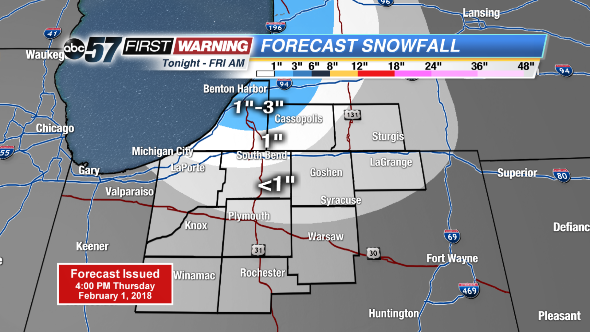
Light lake effect snow showers Thursday night into Friday morning, accumulation up to one inch possible.
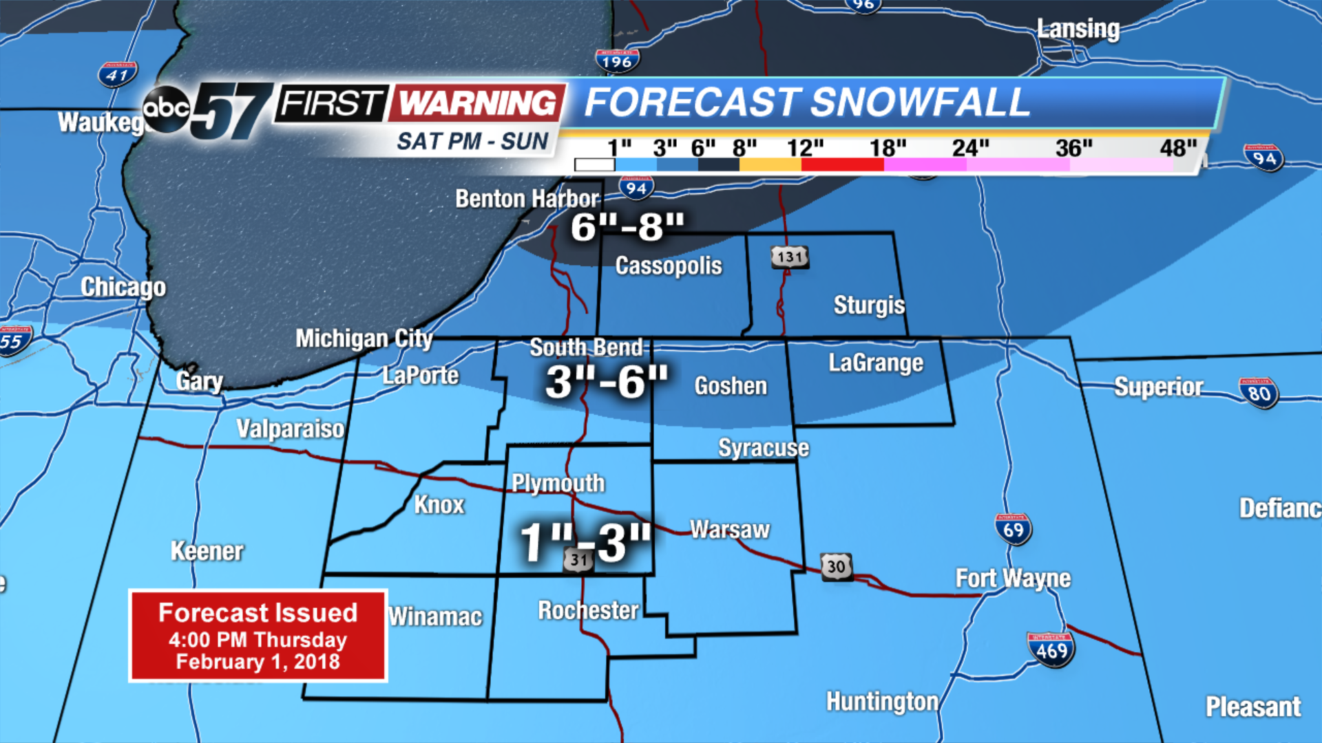
The cold and snowy pattern returns. Light snow and flurries end Friday morning, but temperatures will struggle to break 20. The next round of snow arrives Saturday afternoon and lasts through Sunday. Accumulation of at least three inches is likely for most. The pattern shows no changes for next week with a chance of snow every other day.
Tonight: Mostly cloudy, lake effect snow, low of 10.
Friday: Partly cloudy, chance of snow early, high of 18.
Saturday: Snow by the afternoon, high of 32.
Sunday: Snow showers through midday, highs in the upper 20s.
Sign up for the ABC 57Newsletter