Big boundary keeps Michiana cool and rainy
Posted: May 10, 2018 4:45 PM EDT

-
0:21

Westbound lanes on Indiana Toll Road reopen after crash
-
0:58

Hockey team hosts “Rally for Rudy“ car wash
-
1:06

South Bend School Board of Trustees reviewing the code of conduct
-
2:33

Newly annexed land in Mishawaka could see a Gurley Leep auto...
-
3:48

Farmers react to recent trend of farmland sales in St. Joseph...
-
2:47

Reaction to potential TikTok ban
-
2:49

Michigan City Fire Department holds “Firefighter for a Day“...
-
1:27

Ivy Tech program building future auto technicians
-
2:43

Elkhart elated about Big Balloon Build
-
1:34

Volunteers use Earth Day to spruce up Woodlawn Park Trail
-
3:50

Labor complaint filed over “student athletes“ classification
-
1:17

Rain Tuesday, especially the afternoon

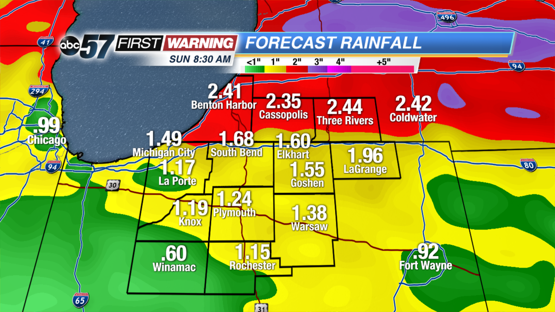
A stationary front will cut a sharp divide in temperatures across North Central Indiana. Most of Michiana will stay in the cool sector, meaning highs in the 50s and 60s but 70s and 80s will loom just to our south. Along that stalled boundary will form rounds of showers and thunderstorms that last through Saturday. These near stagnant systems can lead to excessive rainfall and flooding, more than two inches of rain could fall in the next 48 to 72 hours, minor flooding is possible.
Tonight: Mostly cloudy, chance of showers late, low of 46.
Friday: Mostly cloudy, chance of showers and storms, high of 62.
Saturday: Scattered thunderstorms, high of 62.
Sunday: Becoming partly cloudy, high of 70.
Sign up for the ABC 57Newsletter